
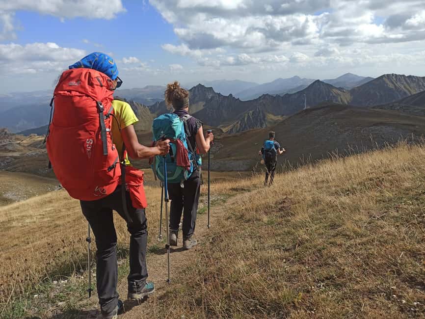
Reviewed · FULL-DAY
Mavrovi Anovi: Guided Full-Day Hike to Golem Korab Peak
One reason this hike is so interesting is that Golem Korab Peak sits on the Macedonia-Albania border, and one climb takes you to the highest point in both countries. I love that it is also the High Scardus Trail highest point, so you are not just summiting, you are ticking a major long-distance hiking landmark. The main consideration is weather. If the mountain turns, the guide may swap the plan to keep the day safe.
In practice, this feels like a well-run “big day” built around local know-how. You start with a 4×4 ride to the Srezimir checkpoint, then hike through old beech forest and into open pasture terrain inside Mavrovo National Park, a UNESCO recognized protected area. I also like that you get snacks and fruit, plus a UIMLA professional guide in English, which makes a 19 km trek feel more structured.
Key things I would circle before you book
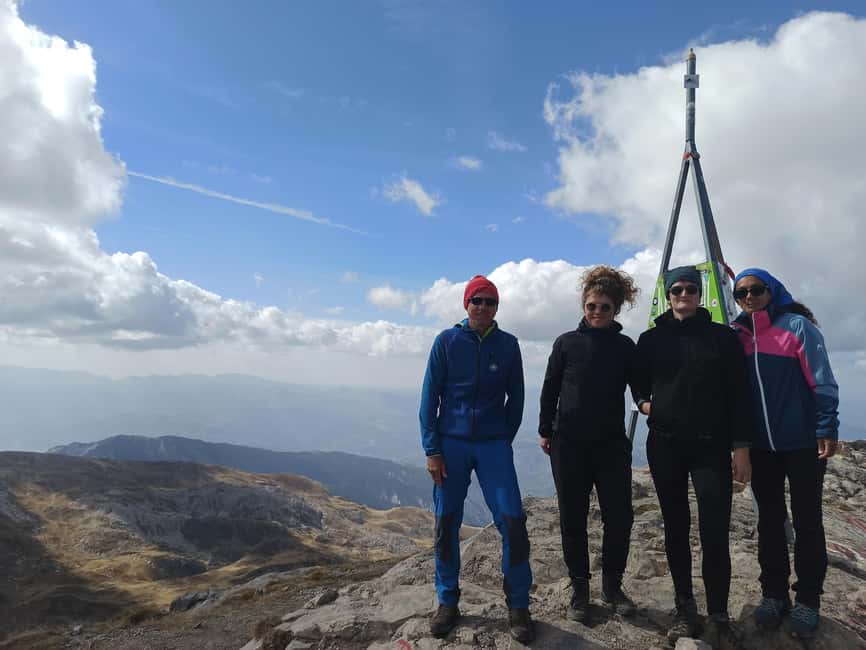
- Border summit, one effort: reach the highest point in both Albania and Macedonia in a single outing.
- High Scardus Trail top point: Golem Korab is the highest point on the long-distance route.
- UNESCO protected hiking: you walk through Mavrovo National Park with biodiversity-focused guidance.
- Old beech forest to pastures: the first climb runs through dense forest before the scenery opens up around 1700 m.
- Weather-smart leadership: one verified experience included a switch to Sandaktash Peak (1981 m) when Golem Korab conditions were too rough, and it still turned into a great hike.
Why Golem Korab Peak is a border hike with real bragging rights
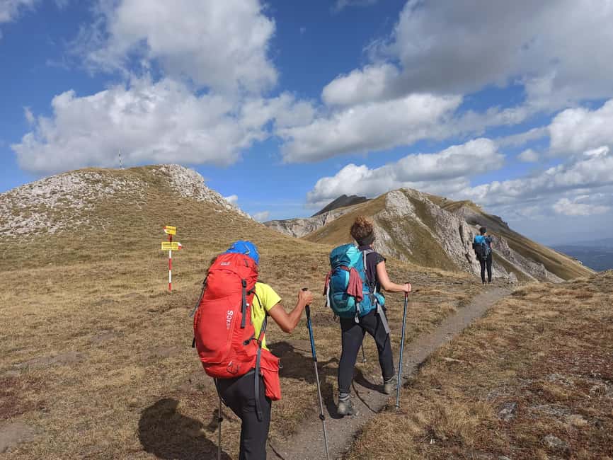
If you like summits that mean something, this one has a built-in story. The peak lies right on the line between Macedonia and Albania, so you get that rare combo of “single hike, double country high point.” That is the kind of detail that makes the day more than just distance and elevation.
I also like the route’s meaning on the wider hiking map. Golem Korab is the highest point on the High Scardus Trail, a long-distance trek. So even if you are not doing the whole trail, you still get to stand at one of its big milestones.
The vibe here is nature first, but not in a silent, detached way. A good guide will connect what you see with why it matters. Expect explanations tied to the park’s biodiversity and the Balkan history and legends that surround the mountain.
Getting to Srezimir by 4×4 from Mavrovi Anovi
The day starts with transportation from Mavrovi Anovi to the hike’s starting point, the Srezimir checkpoint. You travel by 4×4 along a wide dirt road, which is a big deal for this kind of full-day trek. It saves energy for the climb and reduces the amount of time you spend just moving from place to place.
Your meeting point is simple: a petrol station. That sounds almost too plain, but it helps if you are traveling independently. Once you connect with the group, the guide handles the schedule and the transfer.
Because this is a mountain day, the timing matters. The tour runs about 9 hours total, and the hike itself is listed as 6 to 9 hours depending on conditions. That spread is normal in higher terrain, where pace can change fast with wind, sun, and footing.
Through dense beech forest to the pasture zone at 1700 m
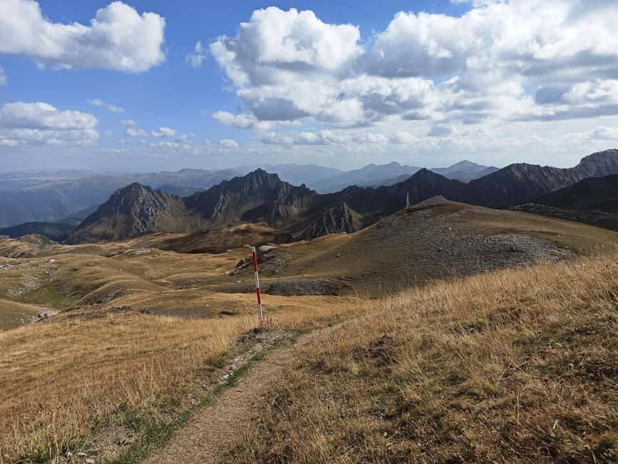
The hike begins with an old, dense beech forest stretch up to about 1700 meters. This part is more than a warm-up. Forest hiking tends to be cooler, and the footing can feel more consistent than open slopes, especially if weather is changeable.
Then you enter the pasture zone. This is where you get a visual shift, from tree shade to wider views and open mountain air. Pastures in this part of Europe are often tied to grazing culture, and they typically frame views of neighboring peaks and ranges in a way the forest can’t.
The best practical mindset for this transition: do not judge the whole day by the first hour. The early forest section can feel steady and even gentle, but you still have 1500 meters of uphill climbing on the schedule. Pace yourself so the pastures do not feel like the start of the hard part. They will already be hard enough.
The climb math: 19 km, 1500 m uphill, and real timing
Here are the numbers that guide how you should prepare. The hike covers about 19 km, with roughly 1500 meters of uphill climbing. Difficulty is rated 3 out of 5, while required fitness is also listed as 3 out of 5. Translation: this is not a beginner stroll, but it is also not an extreme technical climb.
Time-wise, the ascent to the peak usually takes around 3 hours, depending on fitness and weather. The descent is about 40 minutes shorter than the ascent. So if your uphill pace is slower because of wind, or if you have to pause for safety, plan for a longer overall hike.
The route timing also explains why this is described as a full-day tour. Even with a steady group, you have transfer time, breaks, photo stops, and a safety briefing. The 8-hour block inside the national park setting is your clue that the “hike” is more like an entire guided outing, not just movement.
My advice: walk like you are trying to finish comfortably, not like you are racing a clock. If you save energy early, you will enjoy the summit and the views more, and you will descend with better control.
Summit on the Macedonia-Albania border, plus the High Scardus Trail payoff
The highlight is the peak itself. Golem Korab is on the border between Macedonia and Albania, so when you reach the summit, you reach the highest point in both neighboring countries. That fact gives the climb a clean, satisfying goal. It is easy to stay motivated because you always know what you are working toward.
This is also tied to the High Scardus Trail. The tour specifically notes that the peak is the highest point on that long-distance hiking route. If you like trail culture and long routes, that makes the top feel like more than a point on a map. You are part of a bigger network of hikers and routes.
Expect photo stops and guided viewpoints along the way. The tour rates panoramas and landscapes as 5 out of 5, and it also rates biodiversity as 5 out of 5. That combination matters because it changes what the guide talks about. You should expect you will not just stare at the view, you will also get context for what you are seeing and where it fits in the park’s protection.
Mavrovo National Park, biodiversity talk, and cultural add-ons you might add
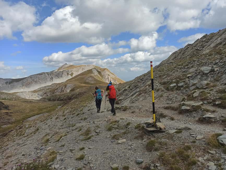
This is one of those outings where the setting does not feel random. You hike inside Mavrovo National Park, and the highlights say the area is UNESCO recognized. That means your guide has a good reason to talk about biodiversity, not just scenery.
The tour data scores cultural-historical sites at 5 out of 5. The way that often shows up in practice is in the stories your guide shares about the mountain and the region’s turbulent past. In the broader company approach, the guides also connect the hike to local traditions.
There may also be a food and farm element. The company notes tours often include a sheep farm visit, with a chance to sample sheep cheese made in traditional ways. Just keep your expectations grounded: farm visits and monument stops are listed as add-ons, not guaranteed in the basic program.
If you want the most “Albania in one day” experience, ask about add-ons after the hike. It is specifically mentioned that depending on wishes, the guide can organize additional activities like cultural places, sites tied to endemic biodiversity, or traditional food tastings. If you are short on time, plan for the hike first, then keep the add-on choices simple.
Price of $247: what you get, and what you still need to pay for
At $247 per person, this is not a budget hike. But it includes the big cost drivers for this kind of day: transportation, park access, and a professional guide.
What is included:
- 4×4 transport to and from the Srezimir checkpoint
- entrance fee to Mavrovo National Park
- an English live guide, described as a UIMLA professional mountain guide
- snacks and fruit
- assistance with tour preparation
What is not included:
- hiking equipment
- food and drinks
- visits or entry to cultural monuments and sites beyond the basic program
So the value comes from the organization, not just from the view. You are paying for reduced hassle (the 4×4 gets you to the start), park logistics (entrance fee), and skilled guidance (the guide matters on steep terrain, especially when weather changes).
My practical budget tip: treat the included snacks as a bonus, not a full lunch plan. Bring your own meal and drinks as the tour expects you to. You will feel better on the last stretch if you are not relying on energy swings.
What to bring for a mountain day (and what to skip)
The packing list here is long, and that is a good sign. It means the tour is built for real mountain conditions, not mild strolling.
Bring:
- passport or ID card
- hiking shoes (and keep them waterproof if you have them)
- layers, including a warm jacket plus rain gear
- sunglasses and sun hat, plus sunscreen
- gloves, long-sleeved shirt, long pants, and breathable quick-dry layers
- daypack, reusable water bottle, and charged smartphone
- GPS or map if you like navigation
- flashlight, hand sanitizer or tissues
- insect repellent
- personal medication and a small first aid kit
- a garbage bag for your trash
The list also makes clear what not to mess around with. Drones are not allowed. Weapons or sharp objects are not allowed. Making fire is not allowed, and you should avoid noise and intoxication in the vehicle.
Also consider these two “small but important” items: change of clothes and a plan for wet footwear. If the weather shifts, having a dry set of socks and a backup layer can save your evening after the hike.
If you are prone to altitude discomfort, remember the tour is designed for people with mountain hiking experience above 2000 meters. The guide also has the final say in safety decisions, especially in emergencies.
Who this guided hike fits best (and who should pass)
This is a private group with English guidance, which often means your pace and needs can be respected better than on big group tours. Still, the physical profile matters.
You should have:
- appropriate fitness level as described (fitness 3 out of 5)
- experience hiking above 2000 meters
- comfort with mountain risks that come with this type of activity
It is not suitable for a wide range of people, including:
- children under 8 years old (the list goes younger, but under 8 is the key cutoff here)
- anyone with back problems, heart problems, vertigo, or respiratory issues
- people afraid of heights
- wheelchair users and people with mobility impairments
- visually impaired people
- anyone over the listed weight limits (the data gives several caps, so be sure to check against your weight)
- people with altitude sickness risk factors, recent surgeries, low fitness, or certain medical conditions listed
If you are healthy, have hiked steep terrain before, and enjoy guided days that mix views with explanations, this is a strong match. If you are unsure about your comfort with heights or exposure, this is one where I would choose a more gentle route.
Weather plan and guide leadership: the Sandaktash example
Mountains do not care about plans. In one verified experience, the weather made Golem Korab Peak not the right choice. The owner of the guiding company recommended an alternative hike to Sandaktash Peak, listed at 1981 meters.
That same day still worked out because the guides stayed hands-on. Linda’s account mentions the father guide Konstantin and his son Tadje, and she appreciated their calm, welcoming approach, plus homemade cookies from the family. That kind of detail matters because it shows the human side of the operation, not just the route.
The tour information also says the guide has the final say on safety decisions in emergencies. So when you book, you should mentally commit to flexibility. If wind is ferocious or the temperature drops, you want the leadership that chooses the safer option quickly.
This is exactly why the “private group” format helps. It can make it easier to adjust the day without feeling like you are stuck in a rigid machine.
Should you book this Golem Korab full-day hike?
I would book it if you want a serious day hike that has meaning built in: a border summit, a major long-distance trail milestone, and a guided walk through a protected area. The route also scores high on biodiversity and panoramas, so you are getting more than just effort for a photo.
You might skip it if you want an easy, short outing. This is 19 km with 1500 meters of uphill climbing. If your fitness is lower than the tour expects, or if heights make you nervous, choose a different hike.
Here is the decision checklist I would use:
- Are you comfortable hiking above 2000 meters and doing a steep, long day?
- Do you have the right shoes and rain plan?
- Are you willing to be flexible if weather forces an alternate peak?
If you say yes to those, this is the kind of guide-led hike that turns into a story you can tell later, because the summit has a real “two countries, one peak” moment built into it.
FAQ
How long is the hike day?
The tour duration is listed as 9 hours. The hiking portion is described as 6 to 9 hours depending on conditions.
What is the difficulty and fitness level needed?
Difficulty is rated 3 out of 5, and required fitness is also rated 3 out of 5. The hike includes about 1500 meters of uphill climbing over roughly 19 km.
How do you get from Mavrovi Anovi to the start of the hike?
You travel by 4×4 vehicle from Mavrovi Anovi to the Srezimir checkpoint, and then return the same way after the hike.
What is included in the price?
The included items are transportation by 4×4 to and from the starting point, the entrance fee to Mavrovo National Park, a UIMLA professional mountain guide, snacks and fruit, and assistance with tour preparation.
Is food or water included?
Snacks and fruit are included, but food and drinks are not included. You should bring your own food and drinks.
What language is the guide?
The live tour guide is English, and the group type is private.
If you want, tell me your hiking background (recent elevation gains and how many hours you usually manage). I can help you sanity-check whether this 19 km, 1500 m uphill day fits your current level.
More Walking with Real Ascent near Mavrovi Anovi
- From Tirana: Bovilla Lake & Gamti Mountain Hiking Day Trip
★ 4.9 · 4,397 reviews - From Tirana: Bovilla Lake & Gamti Mountain Hiking Tour
★ 4.9 · 3,003 reviews - From Tirana: Bovilla Lake & Gamti Mountain Viewpoint Hike
★ 4.8 · 2,053 reviews - Hike Gamti Mountain with Bovilla lake view & canyon- From Tirana
★ 5.0 · 1,280 reviews
Full-Day, compared.
Blue Cave & Grama Bay Full Day Guided Boat Tour
Read our review →
Full Day Tour from Tirana to Prishtina and Prizren
Read our review →Browse the lists this tour appears in